

What fitness levels are required for this event?
This event is an enjoyable sporting challenge for a range of abilities. With appropriate training and preparation you will enjoy completing the event as well as the sense of achievement both individually and as a team member.
Teams generally comprise members of a range abilities and the challenge to the team is to support each other in the various disciplines of canoeing, trail running, mountain biking, hiking etc.The race will test and foster the development of the team in completing this challenge.
The challenge will involve you as an individual and group setting out and agreeing personal and collective objectives. Depending on your objectives you will inevitable be competing against other teams and individuals. How competitive you wish to be will partly depend on your preparation and training.
Training for the hiking and trail running – can following a plan help?
Yes. Many people find it helpful to have a training plan to provide structure and discipline to their running preparation. Remember its stamina and overall pace that you are aiming to develop rather than short distance speed. However the longest distance you will run/jog/ hike will be no more than 14k.
Click here for an idea of a training plan. Another useful event for preparation to is to find your nearest weekly 5k parkrun race which takes place for free every saturday morning in a park near you.
Alternatively, check out the Coopah training app (designed for runners) or check out an upcoming R4W event if you’d like a target to aim for.
Training for the hiking and trail running – training techniques
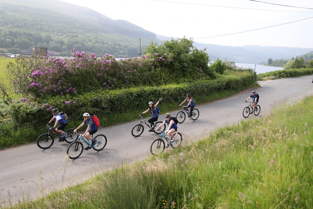
Trail running and hiking during this event is largely off road – mostly along varied mountain footpaths and tracks, often in hilly areas and sometimes over open moorland. So training in similar terrain is ideal.
Just getting off the gym treadmills or pavements into your local park or nearby green area will pay dividends. This will strengthen your joints especially ankles and knees in readiness for going off road whilst racing. Build up gradually from circa 2 mile runs to being able to accomplish around 5 miles. You should also look to include hills into your training runs.
Additional information on techniques for fell running and hiking
Canoeing – guides and techniques
Do I need any special kit for the canoeing stage? No. All canoeing kit is provided for all team members. This includes a buoyancy aid, an offset paddle per person and a sit on top kayak. I’ve not canoed before. What’s the best technique? Probably around 30-40% of competitors have not canoed before so don’t worry! The basic technique is easy to pick up and the safety marshals will provide the basics – just tell them when you get to the water that you’d like some help.To learn more, watch one of the following videos:
Food, drink and nutritional guides – what should I eat and drink?
- Water will be available throughout the 2 day Adventure Race as well as snacks such as flapjacks, bananas etc.
- Dinner will be provided on Thursday evening and post race on Friday evening and Saturday.
- Breakfast and lunch will NOT be provided, please ensure you have prepared lunch bag for both days.
- Like an engine your body needs the right fuel to work effectively. Paying attention to your diet in the weeks before a race and in the immediate period prior to racing are important components to good preparation.
- Here is a basic guide to what to eat and drink to improve your adventure racing.
How can you best aid recovery post training or racing?
You’ll enjoy your training and racing so much more if you eat and drink the right things in the time period after exercise. To find out more, read a 60 second guide to rest and recovery here.
Navigational information and simple guides
How well do I need to be able to map read and navigate?
The cycling stages will have arrows throughout to help your navigation, hiking and running stages will have minimal signage if any at all. Part of the challenge is for you to work as a team and read the provided OS map and stage route descriptions. Marshals will be present throughout all stages to make sure you don’t go too far off track and there will be GPS trackers for each team.
Whilst you don’t need to be an expert, being able to read a map and conduct simple navigation are key skills. You won’t need to go off public rights of way to find them. This is not technical orienteering. It’s much simpler than that. You’ll be using a good quality copy of a 1:50,000 Ordnance Survey map. It’s normally A3 in size and printed on high quality waterproof paper. Schematic maps will show the start and end of each stage as well as transition zones. Use these maps in conjunction with the OS map provided to each team to find your way.
Can’t I just use a GPS to find my way?
No. GPS’s are not allowed to be used. Navigating by map reading and compass are all part of the fun of adventure racing.
Where can I learn more about Ordnance Survey maps and map reading?
The Ordnance Survey (OS) website is a good starting point; you can download a beginner’s guide to map reading here.
It’s important that you know how footpaths, cycle routes, bridleways and other public rights of way are depicted on an OS map. A good working knowledge of the common key symbols used on OS 1:25,000 maps is really useful. Download the key to these maps here , to find out more.
Do I need to plot grid references?
An understanding of the OS grid system in your team will be useful for you to find start and finish points. We have also provided What3Word locations for the start and end of each stage.
Do I need to be able to use a compass?
Most of the navigation can be conducted without a compass. That said knowing how to use a compass is a useful to quickly check you are going in the right direction or to chose the right route at a track junction. It’s also useful if you do get lost and need to relocate.
Click on the links below to read:
- A simple guide to taking and following bearings using a compass and how to triangulate (ie how to find your position in a landscape with the aid of a compass )
- A good graphical summation of how to take a bearing from a map
Risk and safety
- Event staff hold valid First Aid Certificates and most have a wide range of Outdoor Instructor Qualifications, many at the higher levels, rather than entry level qualifications.
- The safety and wellbeing of all our clients/ competitors is our collective and primary concern. The safety and risk management plan has been meticulously prepared to cover eventualities and variables.
- All competitors, staff/ marshalls and partners receive a comprehensive risk and saefty briefing.
- A Mountain Rescue team will be providing additional first aid, safety and radio communications support.